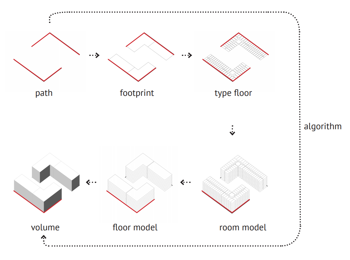
DEVELOPMENT MODELLING
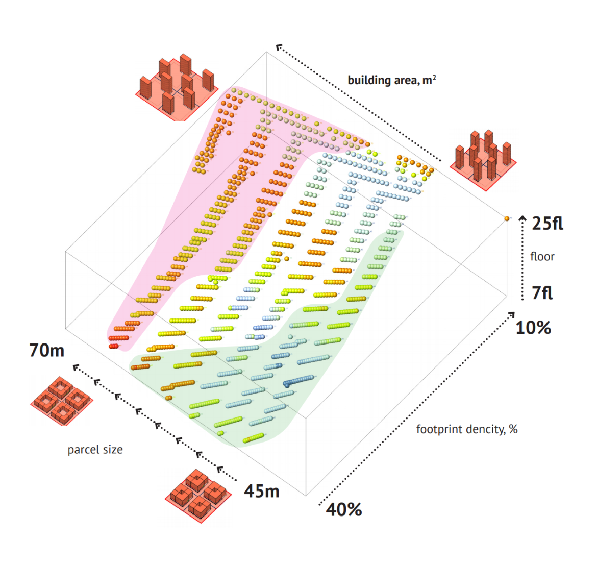
Development is a parametrical system with defined raw data, attribute data and final result.
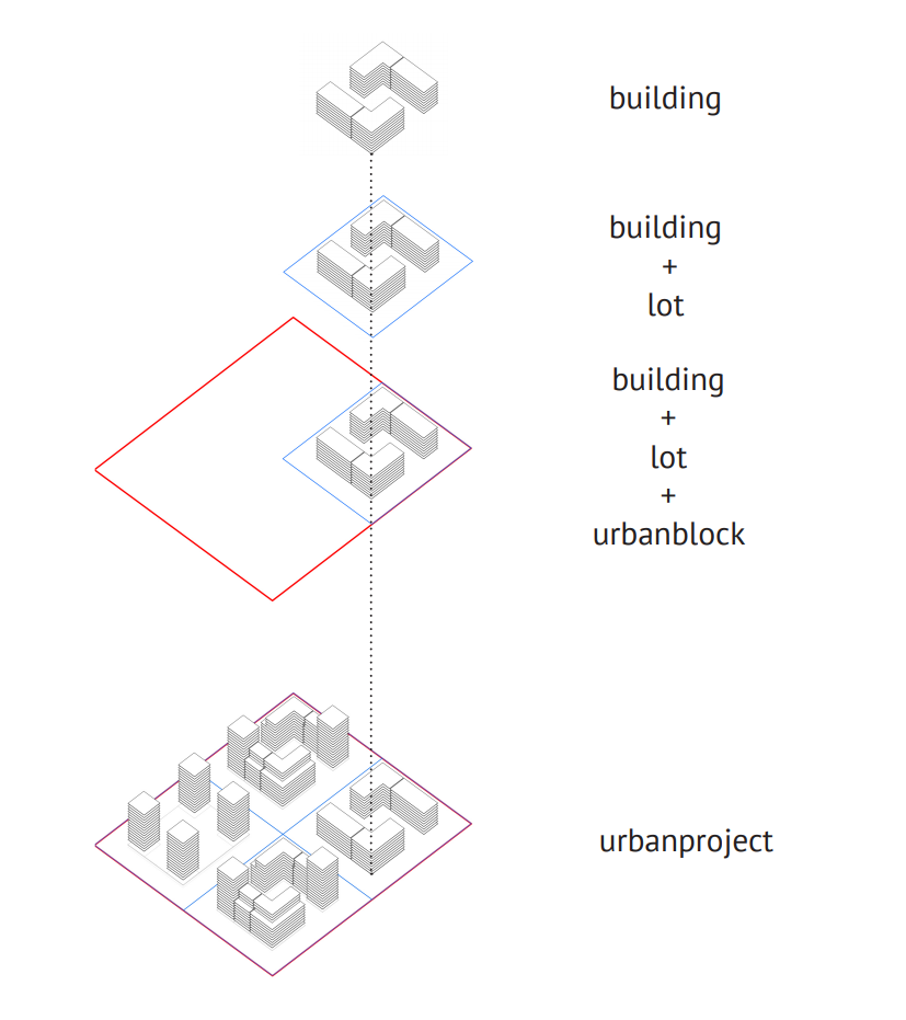
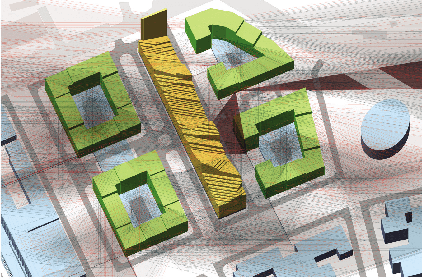
AREA MODELLING
Urban development is approached in conjunction with the land plot where it is located and a block that surrounds it.
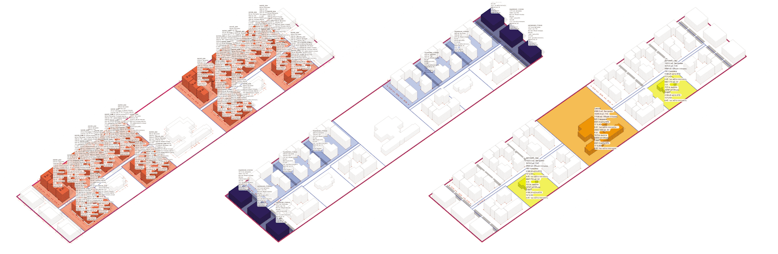
DATA-BASED PROJECTION
Urban planning project is based on context and situational analysis, which establishes planning restrictions applicable at the site. During the projection process, a series of options are developed. Each option takes into account one of the limiting factors. The influence of each factor is evaluated both independently and combined, which helps to determine the level of restrictions’ influence.
Each option in a series is a finalised spacial solution that defines technical and economical factors and risks involved in its execution. The chain of options is a connected system, not a selection of different developmental visions. This quality allows elaborating both view and strategy for working with the site.
TYPOLOGY
Development is a parametrical system with defined raw data, attribute data and final result.
ADVANTAGES OF COMPUTER PROJECTION
Accurate integration of technical specifications, current planning restrictions and results is made possible due to computer projection technologies. This digital integration makes the change-making process smooth and seamless may it be changes in storeys, building density, or land boundaries.
Therefore the calculation of the site capacity optimal balance and perceived risks is data-based. Furthermore, it becomes available for urban planners to track down dynamics in time, changes in raw data and the level of their influence on a final result.

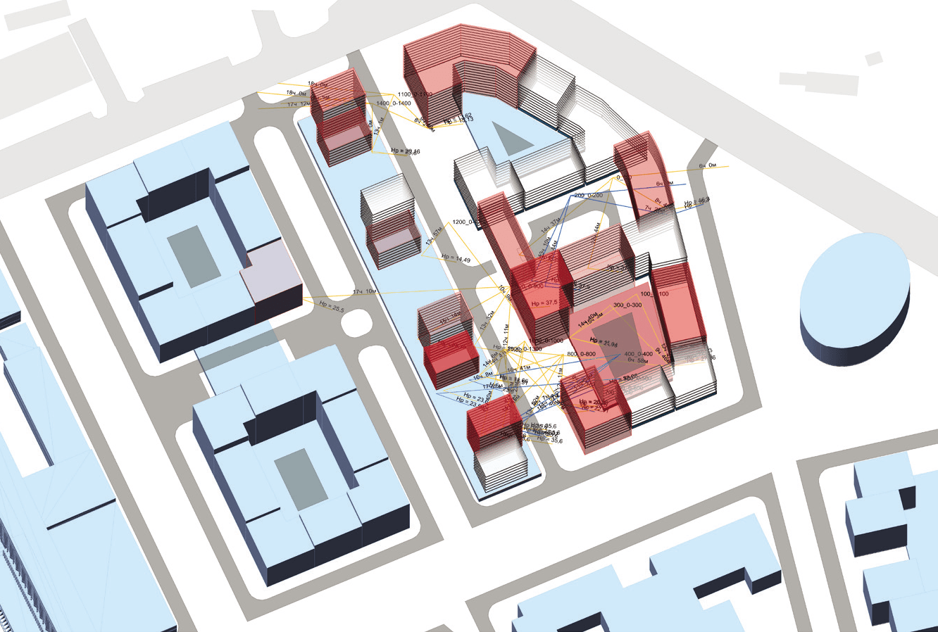
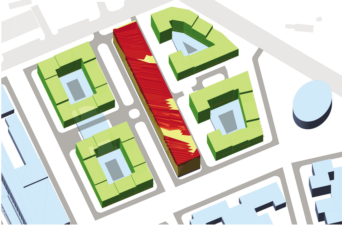
CALCULATION OF INSOLATION
Insolation has a significant impact on the developments’ configuration and capacity. The scenario approach allows determining the impact of insolation standards.
The algorithm takes into account all the necessary parameters, such as the geometry of the windows, the presence of balconies, building height, landscape.
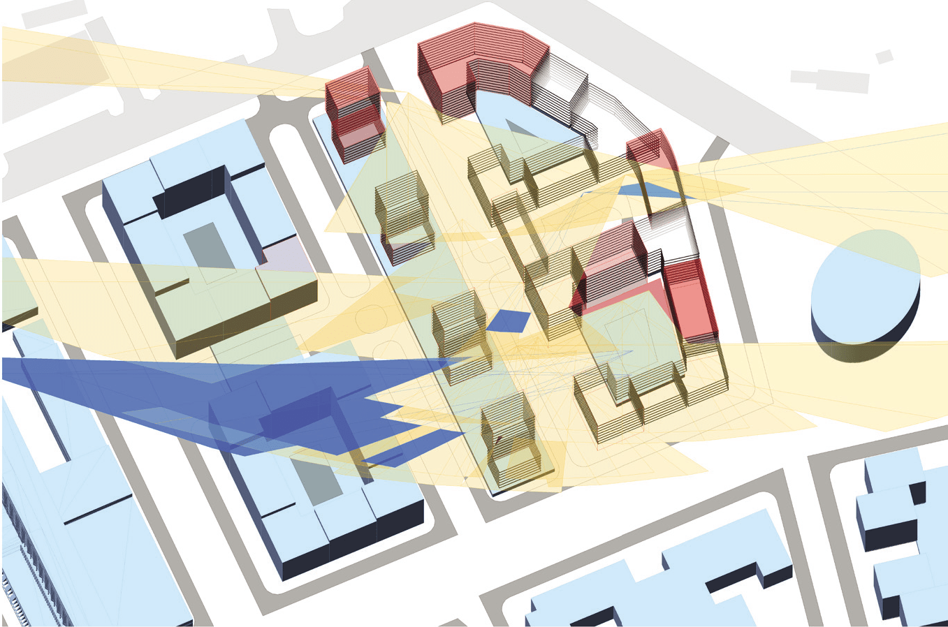
RAYS
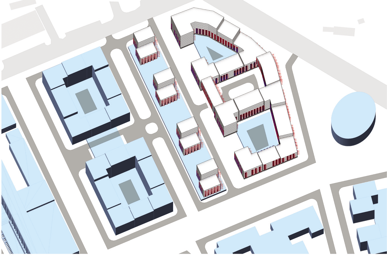
MASSING
REPORT
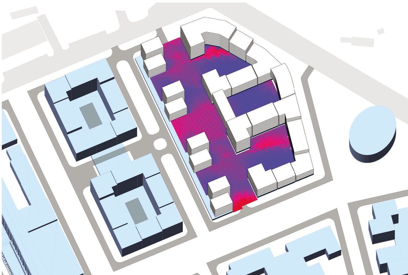
WINDOW INSOLATION MAP
TERRITORY INSOLATION MAP
LIMITATIONS
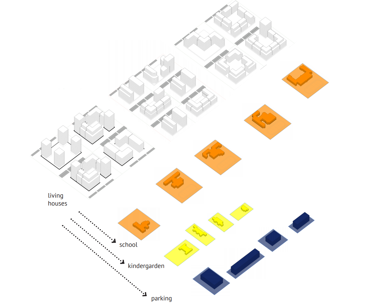
DESCRIPTION OF THE PROJECT
Technical and economic indicators calculated for building/land plot/block.
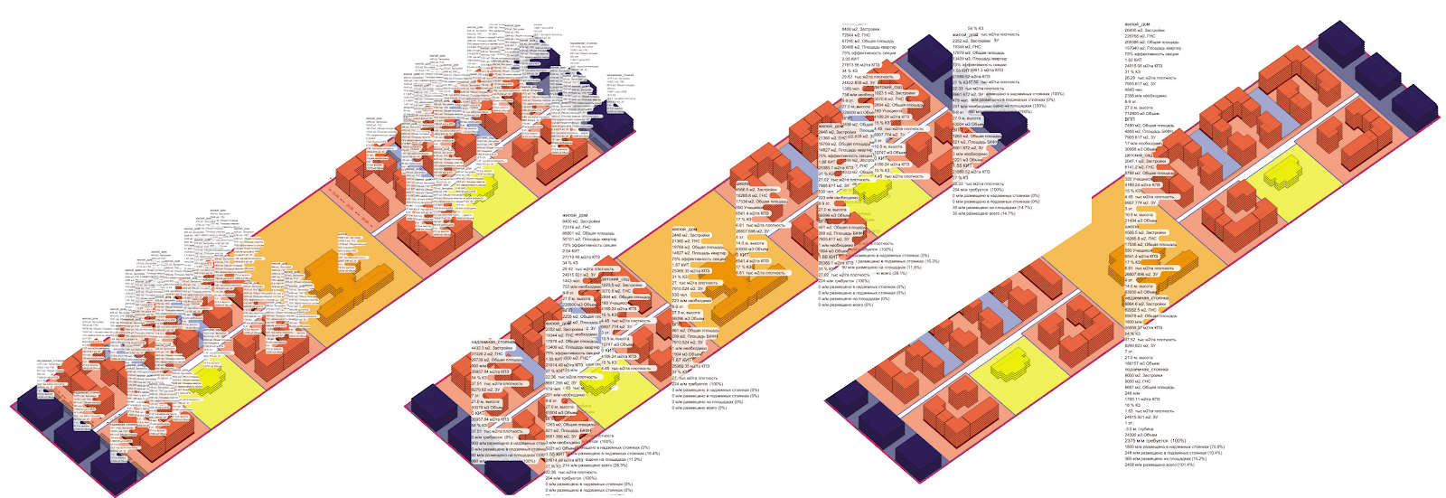
Calculation of indicators for residential buildings, parking, kindergartens and schools.